English| EUR
Suggested for you
More currencies
Choose a language
Copenhagen ranks among the world's most bike-friendly cities, with over 380 kilometers of dedicated cycling infrastructure threading through neighborhoods, parks, and waterfront districts. Understanding the city's bike lane network, route options, and landmark positions helps you plan efficient tours that balance distance with sightseeing priorities.
Quick answer
A bike tour Copenhagen map shows the city's extensive network of protected bike lanes, major cycling routes connecting districts like Nørrebro, Vesterbro, and Christianshavn, and landmark positions including Nyhavn, The Little Mermaid, Rosenborg Castle, and Freetown Christiania. Most self-guided tours cover 10–15 kilometers and take 2–3 hours at a comfortable pace. The cycling infrastructure uses clear signage and dedicated lanes separated from car traffic, making navigation straightforward even for first-time visitors.
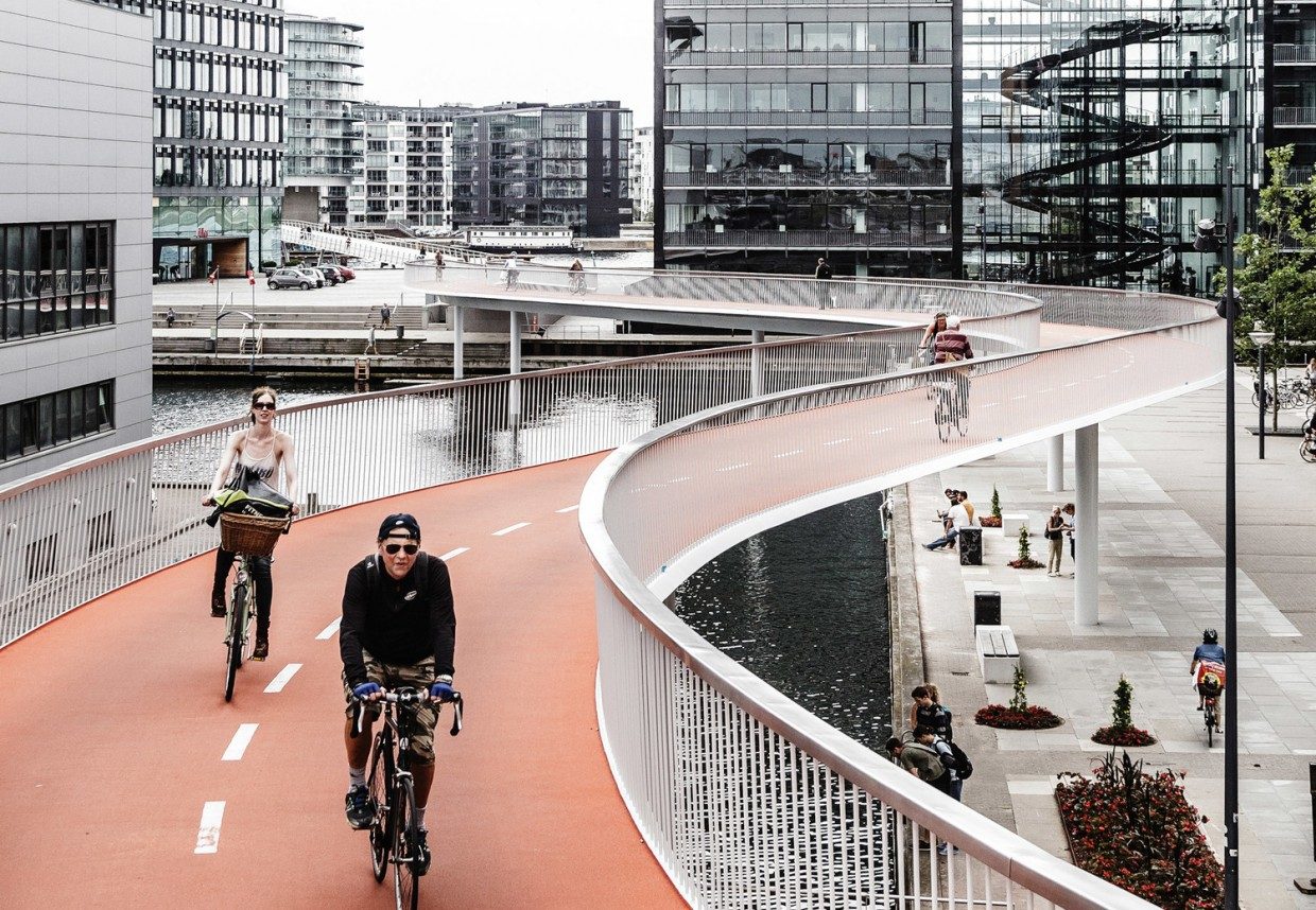
More than 62 percent of Copenhagen residents commute by bicycle daily, a figure that reflects both infrastructure investment and cultural practice spanning generations. The city's flat topography and maritime climate created ideal conditions for cycling adoption, while decades of urban planning prioritized bike lane expansion over car-centric development. The cycling network divides into several distinct route types. Green Cycle Routes form the backbone, comprising 110 kilometers of paths designed for recreational riding with minimal intersection stops and priority signaling at crossings. These routes connect parks, waterfront promenades, and residential districts while avoiding heavy traffic corridors. Supercykelstier, or superhighways, extend outward from the city center toward suburban municipalities, offering fast commuter corridors with synchronized traffic lights and air-pump stations at regular intervals. Within the historic center, dedicated bike lanes run parallel to pedestrian zones and vehicle streets, marked by blue painted surfaces and white bicycle symbols. Landmark density concentrates in three primary zones. The Indre By district holds Nyhavn's colored townhouses, Amalienborg Palace, and The Little Mermaid statue within a two-kilometer radius. The Lakes circuit wraps around Sortedams Sø, Peblinge Sø, and Sankt Jørgens Sø, passing Assistens Cemetery where Hans Christian Andersen rests. Christianshavn and its canals lie across Inderhavnsbroen bridge, with Freetown Christiania occupying former military barracks northeast of the neighborhood center. A bike tour Copenhagen map reveals these clusters and the optimal connecting routes between them. Navigation tools range from printed municipality maps distributed at tourist offices to GPS-enabled mobile applications showing real-time bike lane conditions and elevation profiles. The Copenhagen Cycle Map, published by the City of Copenhagen, details all official routes with distance markers and points of interest coded by category. Most guided tour operators provide laminated route cards marking rest stops, photo opportunities, and historical context at twelve to fifteen waypoints. Self-guided riders benefit from downloading offline maps before departure, as cellular coverage can fluctuate in canal-side areas and park interiors. Seasonal considerations affect route selection and comfort. Autumn months bring shorter daylight windows and occasional rain, making waterproof gear and early starts advisable between October and March. Summer sees extended evening light until 22:00, allowing flexible departure times and sunset rides along harbor routes. Spring and early autumn offer moderate temperatures and lower tourist density on shared paths, particularly on weekdays when commuter traffic dominates morning and evening hours but leaves midday routes relatively clear.
“Green Cycle Routes comprise 110 kilometers of paths designed for recreational riding with minimal intersection stops and priority signaling at crossings.”
The best arrival window for your bike tour is 09:00–16:00, which provides optimal daylight and avoids the high congestion of local rush hours. Planning your route during these hours ensures a safer and more efficient experience on the city bike paths.
Mild, 12°C–20°C
Long daylight hours allow for extended exploration of the city map. High season crowds are manageable if you avoid morning and afternoon commuter peaks.
Warm, 15°C–23°C
This is the peak period for tourism in Copenhagen. Stick to the 09:00–16:00 arrival window to navigate bike lanes with ease.
Cool, 8°C–16°C
Fewer tourists visit during these months. The weather remains suitable for cycling, and bike paths are generally quieter outside of work commutes.
—
Arriving between 09:00 and 11:00 on weekdays allows you to navigate the city after the main rush. This provides the most relaxed pace for following a self-guided route.
Verdict: The optimal time to follow a bike tour map is Tuesday to Thursday between 09:00 and 16:00 during the months of May, June, or September.
Navigating Copenhagen by bicycle relies on the city's extensive public infrastructure. There are no entrance fees required to access the city streets or designated bike paths.
Verdict: A typical adult pays 0 DKK to access the cycling network, though individual equipment rental or guided tour costs may vary.
Copenhagen, Denmark, is a highly cycle-friendly city with an extensive network of bike paths accessible from all major transportation hubs. Navigating to your starting point is most efficiently achieved by using the city's integrated public transport system or by cycling directly to your designated route coordinates.
DSB regional trains to Copenhagen Central Station (København H)
Lines M1, M2, M3, or M4 to Kongens Nytorv
Line 1A or 5C to city center stops
Follow city signage to Inderhavnsbroen or major bike arteries
For the most efficient start to your route, utilize the Copenhagen Central Station area as a central hub to access major bike paths. Refer to your map to align your departure with the city's marked cycle superhighways.
Navigate Copenhagen like a local by mastering the specific flow and signals of the city's extensive cycling infrastructure.
Extend your arm straight out to indicate a turn and raise it vertically to signal a stop. This standard hand signaling prevents collisions with the consistent stream of cyclists behind you.
Keep to the right side of the bike lane to allow faster commuters and cargo bikes to pass on your left. If you need to stop, pull completely out of the bike lane to avoid obstructing traffic.
At intersections, wait in the bicycle box—the space marked for bikes ahead of the car stop line. This position makes you visible to turning drivers and allows you to clear the junction safely when the light changes.
When turning left at busy intersections, do not cross traffic lanes diagonally. Instead, ride straight across the intersection, stop in the designated area, and wait for the light to change in your new direction.
Always stop behind bus doors if a bus has pulled up to a stop. Local traffic regulations require cyclists to wait until passengers have finished boarding or exiting before proceeding past the bus.
A few practical steps will ensure smooth navigation and comfort during your self-guided ride through Copenhagen.
Everything you need to know about bike tour copenhagen map
While Copenhagen is exceptionally bike-friendly, a bike tour copenhagen map helps you identify the most scenic paths between major sites. Many visitors prefer using digital guides to navigate the extensive network of cycle tracks.
The best arrival window for cycling is between 09:00 and 16:00 to enjoy optimal daylight. This timeframe also helps you avoid the heaviest traffic congestion associated with local rush hours.
There is an entrance fee of 0 DKK for using public city streets and bike paths. You have free access to the entire infrastructure maintained by the city of Copenhagen.
Yes, the city is very family-friendly with dedicated lanes and flat terrain suitable for younger riders. Always check your equipment and local traffic rules before starting your journey.
The most common mistake is failing to account for the prevailing wind or underestimating the time needed to reach specific monuments. Planning a realistic itinerary based on a bike tour copenhagen map ensures you do not feel rushed during your sightseeing.
You can find professional guides and group excursions through official tourism channels. These providers often supply a physical or digital bike tour copenhagen map as part of your booking.
The city is designed with cyclists in mind, featuring clear signage and well-maintained pathways. Following a reliable bike tour copenhagen map makes it simple to visit iconic spots like the Little Mermaid or Nyhavn safely.